CIV E 445 - APPLIED HYDROLOGY
SPRING 2014
LAB No. 3
Determine, by planimeter measurement, the drainage area of Tierra del Sol Creek, in Southeast San Diego County, at its intersection with the U.S.-Mexico International border. The geographical coordinates of the intersection are:
32° 35' 57.61" N, and116° 20' 55.10" W. Using the Pfafstetter methodology, determine the watershed topology for the Tierra del Sol watershed delineated in Problem 1. For practical convenience, assume that the level 1 code is 5.
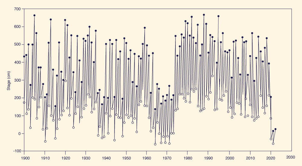
The maximum annual peak flow has been measured in the Ladario gage of the Upper Paraguay River, Brazil (see figure below). The record length is from 1900 to 2008. Determine the stage (cm) that has been exceeded 50% of the time.
|